In August 2013, we embarked upon a trip to Greenland. With its ice cap and glaciers melting at a rapid rate, Greenland is often at the center of the climate change conversation. It is far off the beaten path — so vast and remote — that even today exploring Greenland seems reminiscent of the spirit of exploration of centuries gone by. Our small ship expedition took us deeper into the fjords of this pristine Arctic wilderness — where large vessels simply cannot go.
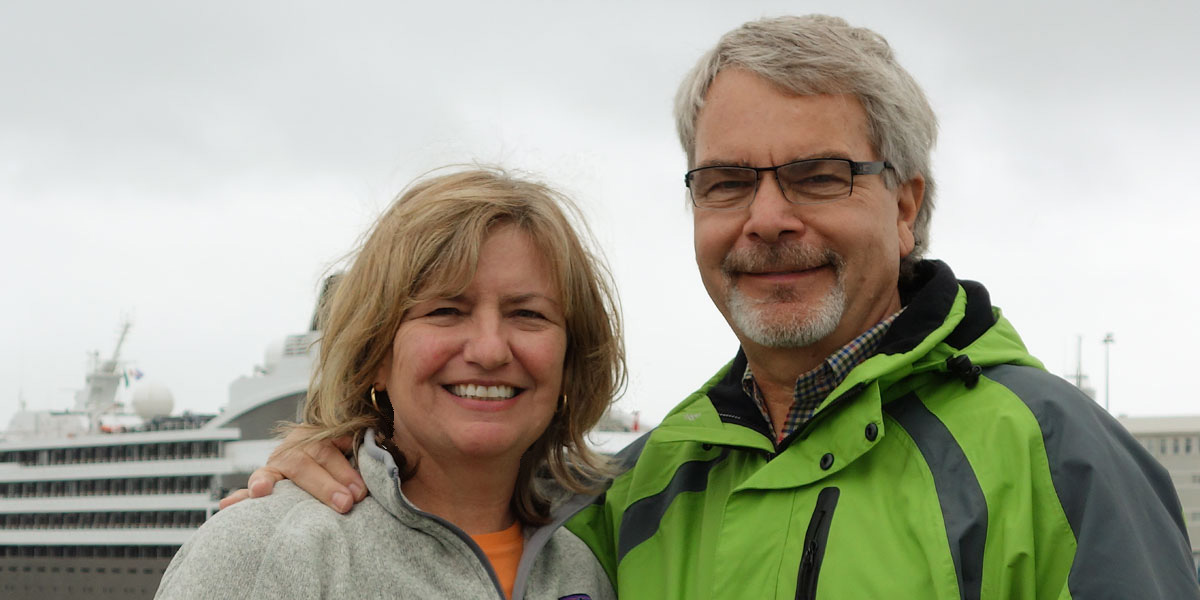
Peter and I began our journey with a few days in Iceland and then met up with a group of six other alumni from the University of Michigan as we sailed from Reykjavik across the Denmark Strait to Cape Farewell at the southernmost point of Greenland. From there we sailed north along the western coast to Disko Bay and the Eqi Glacier above the Arctic Circle. Along the way we visited the old Norse settlement of Narsaq and Greenland's capital Nuuk — along with many beautiful inlets, tidewater glaciers, and fjords.
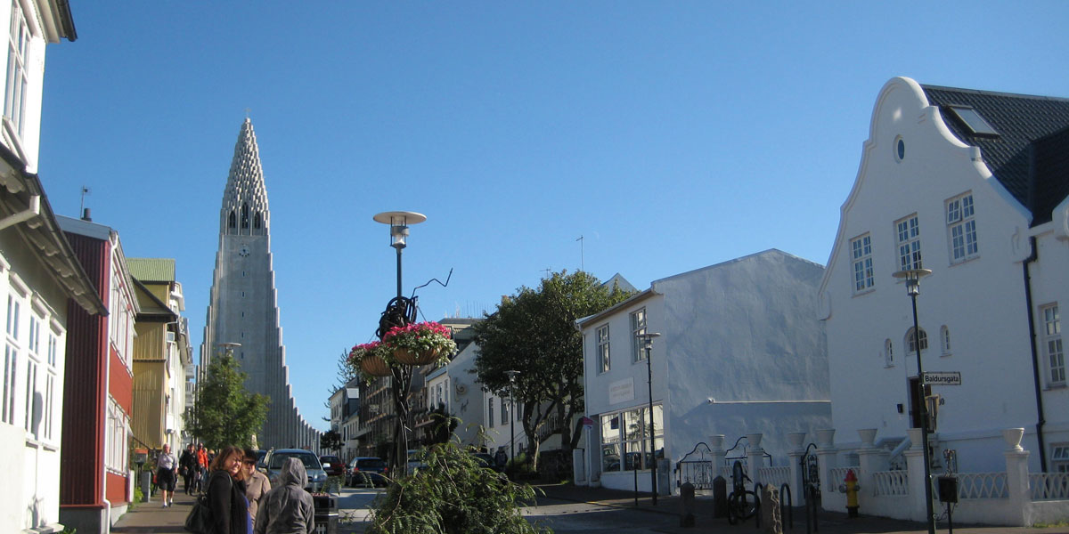
Overview of the city of Reykjavik, Iceland
Starting Out in Iceland
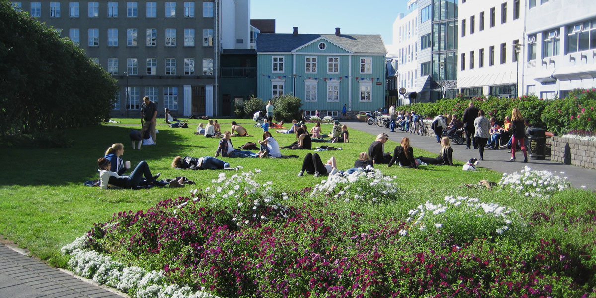
Despite Iceland's name, ice only covers about 10 percent of the land, but it home to the largest glaciers left in Europe. We spent our first day exploring Reykjavik — the capital city. Reykjavik has a very youthful vibe with giant wall graphics and lots of entertaining public sculptures.
Creative graphics in downtown Reykjavik
Sculpture by the lakefront in Reykjavik
Happy message in Reykjavik
Two key landmarks in Reykjavik include Hallgrímskirkja and the Harpa Concert Hall. Hallgrímskirkja is a Lutheran parish church designed by Icelandic architect Gudjon Sauelsson. At 144 feet high, it is the largest church in Iceland and the tallest building in the country. Construction began in 1945 and was completed in 1986. The award-winning Harpa Concert Hall is located on the waterfront and its first concert was conducted in May 2011. Designed by Henning Larsen Architects, the building features a distinctive colored glass facade inspired by the basalt landscape of Iceland.
1 / 9
Downtown Reykjavik with the imposing Hallgrímskirkja Church
2 / 9
Reykjavik residents enjoying a sunny day
3 / 9
Reykjavik waterfront with the Harpa Concert Hall
4 / 9
Thingvellir National Park
5 / 9
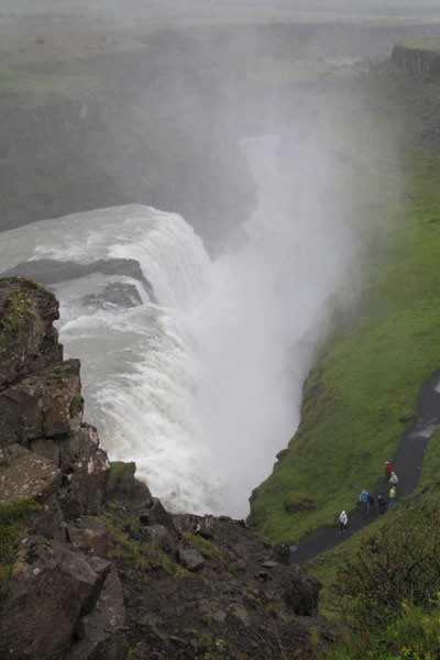
Gullfoss Waterfall (note the scale of the people on the path)
6 / 9
Peter hiking along the Gullfoss Waterfall
7 / 9
Reception at the Hellisheidi Geothermal Power Station
8 / 9
Behind the scenes at the Hellisheidi Geothermal Power Station
The next day, we visited Thingvellir National Park — a UNESCO World Heritage site — where settlers founded the world's oldest parliament in A.D. 930. I felt the sheer force of the Gullfoss waterfall where crystal-clear glacial waters drop 96 feet into a famous crack in the earth. It is the surface expression of the Mid-Atlantic Ridge — also know as the "spreading center" driving Continental Drift — and made famous in the movie Hunt for Red October. We then experienced the famous geothermal waterspouts of the Great Geysir. Later in the day we took a tour of the Hellisheidi Geothermal Power Station — the second largest geothermal power plant in the world. Geothermal power provides low-cost heating and hot water for 8 percent of Iceland's buildings.
Geysir geothermal area
A split second before the Great Geysir blows
Iceland's Great Geyser
Walking around the Gullfoss Waterfall
Leif Erickon monument in front of Hallgrimskirkja
Boarding the Le Boreal
Our ship — Le Boreal — is owned and operated by the French cruise line company Compagnie du Ponant. The ship is 466 feet long and accommodates 264 passengers. As we will find out later in our journey, its hull is ice-hardened and equipped with advanced maneuvering technology which allowed us to travel under extreme ice conditions.
Our captain was the famous Captain Patrick Marchesseau. In 2008, the yacht he was captaining was hijacked by Somali pirates. The pirates held he and his crew captive for a week aboard Le Ponant, the 288-foot luxury sailing yacht, before they were freed by French commandos in a raid.
Heading for Greenland
In the evening, our ship left the harbor and we started our expedition to Greenland — the world's last true wilderness that is nearly covered by an ice cap that holds 10 percent of the world's fresh water reserves. Greenland is an autonomous nation residing within the Danish Kingdom. Eighty percent of Greenland's 55,000 residents are Inuit with the rest primarily Danes.
From Reykjavik, we headed southwest across the Denmark Strait where the cold East Greenland Current carries icebergs out of the Arctic into the Atlantic Ocean. Our initial destination was Cape Farewell and the Christiansund Fjord. Cape Farewell is at the southernmost point of Greenland, projecting into the North Atlantic Ocean and the Labrador Sea. It is at same latitude as Anchorage and Stockholm.
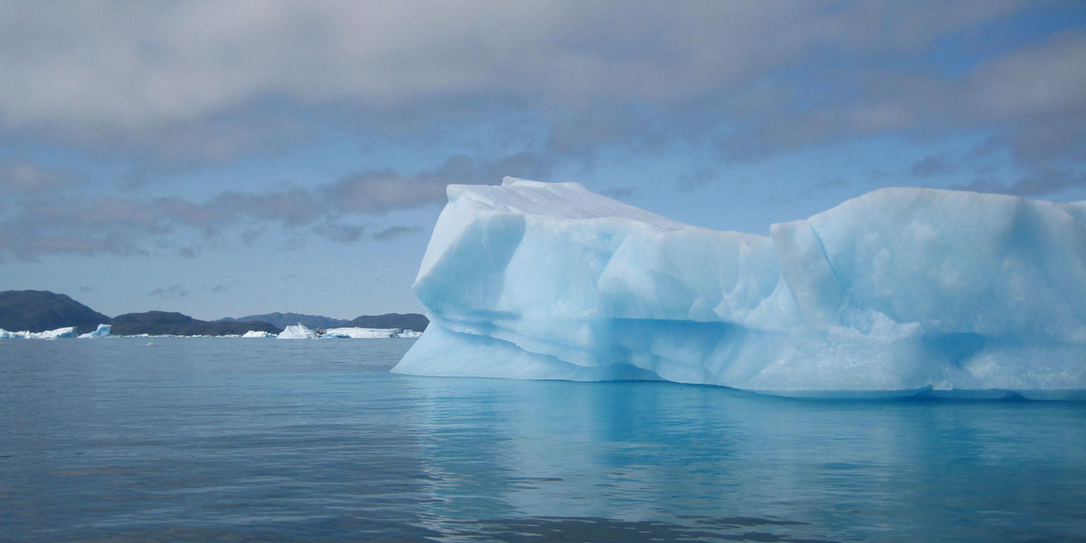
First Iceberg Sighting
We were excited to see our first iceberg. The many forms of the giant tabular icebergs are like living art, dazzling in the light and mysterious in the fog and creating an aura of vastness.
Our first iceberg sighting
A tight squeeze as we enter Christiansund Fjord between Cape Farewell and Greenland
Approaching our first tidewater glacier at the Christiansund Fjord
Hvalso and Narsaq
As we began to explore the western coast of Greenland and its endless inlets and ice floes, we stopped at the old Norse settlement of Hvalso — Greenland's largest Viking ruins. This was my first experience disembarking the ship via the Zodiacs which were the only way we could reach shore during our Greenland journey with the exception of Nuuk. We then visited the town of Narsaq which is located on the shore of the beautiful Tunulliarfik Fjord.
Shear cliff with waterfall at Christiansund Fjord
Viking ruins at Hvalso (note Peter on the ridge in upper right)
1 / 7
Icebergs at Narsaq
2 / 7
Boarding the Zodiacs taking us to Narsaq
3 / 7
Town of Narsaq with its colorful buildings
4 / 7
Beautiful ice formations as we head back to our ship (on left)
The next day we arrived at Greenland's capital city of Nuuk — located on an island in the Nuup Kangerlua Fjord on the eastern shore of the Labrador Sea. With about 13,000 inhabitants, Greenland's largest city is also the northernmost capital in Europe. Back on board in the evening, we met with Greenland's municipal Councillor (Henriette Rassmunssen) who is also a noted journalist.
Panoramic view of Nuuk with Cynthia posing on the right
We spent several hours in Nuuk at the Greenland National Museum. The museum has many artifacts related to archaeology, history, art, and handicrafts and also has information about ruins, graveyards, and buildings throughout Greenland. The building design is based in a warehouse which was built in 1936. A famous display contains the Qilakitsoq mummies. The three well-preserved women and a six-month-old child were buried in 1475 and were found in two graves at the Qilakitsoq settlement in northwest Greenland in 1972.
Historic photo of musher and dogs at the Greenland National Museum
Late Thule culture bone sculptures at the Greenland National Museum
One of the Qilakitsoq mummies with child at the Greenland National Museum
Kitsisarssuit Island
The following day we visited the small Inuit village of Kitsisarssuit that sits on an island in Disko Bay. I arrived by Zodiac to a little sheltered harbour filled with fishing boats. Less than one hundred people live on the island and their life revolves around fishing and hunting. It was windy and cold but the view from the top was outstanding and we saw wildflowers and a pair of young Arctic foxes along the way.
Panoramic view of the Eqi Glacier area (note Peter on on far left in green jacket and our ship down below
Eqi Glacier
At our next stop, I gained insight into the lives of the French anthropological and geographic explorers of the 1950s at the Paul Emile Victor Base at the Eqi Glacier. We hiked up to a panoramic view of one of the Arctic's most beautiful places overlooking the spectacular glacier and out towards the immense ice cap. The silence was broken only by the roaring and cracking of the ice as it moved.
Greenland flag flying atop Kitsisarssuit Island
I arrive by Zodiac for a hike to the Eqi Glacier
1 / 6
Kitsisarssuit village
2 / 6
View from the village of Kitsisarssuit
3 / 6
Peter and I at the top to view the Eqi Glacier (behind)
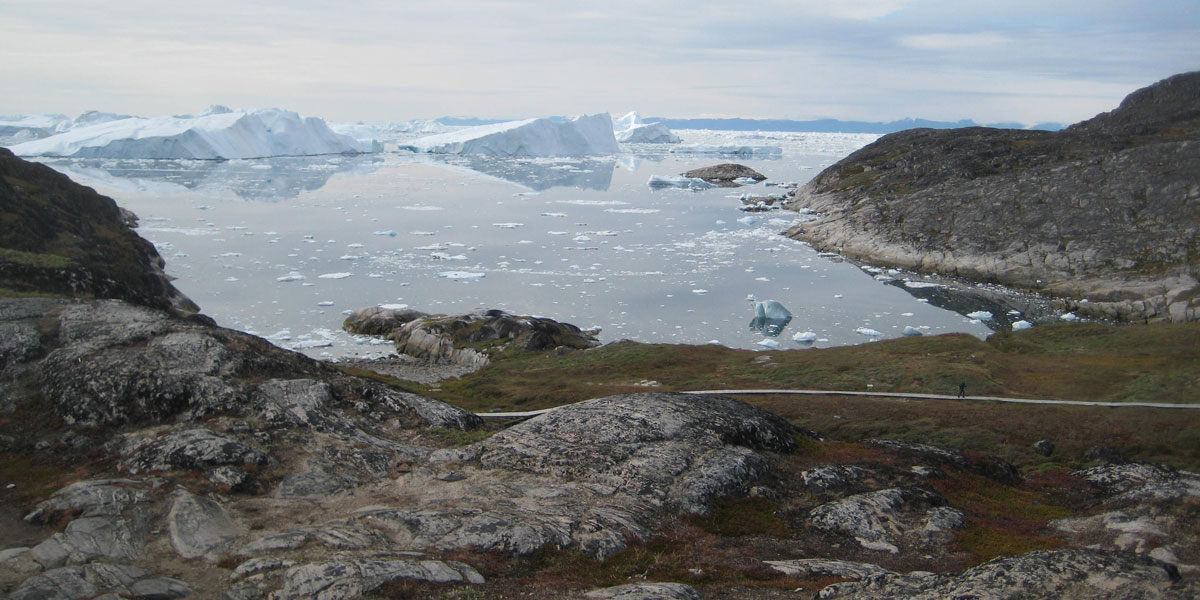
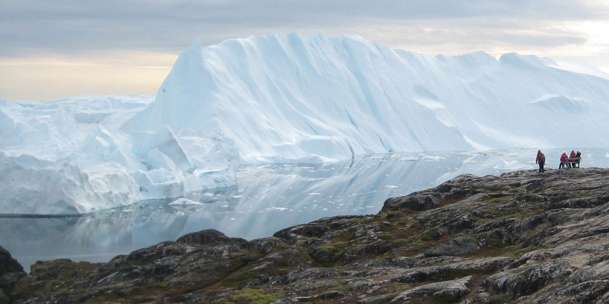
Our visit to the Ilulissat Ice Fjord was the highlight of our expedition. Located 150 miles north of the Arctic Circle, the Ilulissat Ice Fjord is the sea mouth of Sermeq Kujalleq, one of the few glaciers through which the Greenland ice cap reaches the sea. Sermeq Kujalleq is also one of the fastest and most active glaciers in the world. Studied for over 250 years, it has helped develop our understanding of climate change and ice-cap geology. The combination of a huge ice-sheet and the dramatic sounds of a fast-moving glacial ice-stream calving into a fjord covered by icebergs make for an awe-inspiring natural phenomenon. The Ilulissat Ice Fjord has been a UNESCO World Heritage site since 2004. We began the day touring the Ilulissat Ice Fjord from the water. Small fishing boats took us through Disco Bay amidst the most amazing floating ice sculptures in the world.
1 / 8
We started our trip through Disco Bay on a fishing boat
2 / 8
Discovering the beauty of Disco Bay
3 / 8
More beautiful icebergs
4 / 7
You can see how incredibly close we were to the ice
5 / 8
Striking ice formations
6 / 8
The beauty goes on and on
7 / 8
View of one of the fishing boats
8 / 8
I head back to our ship after an exciting (but very cold) morning
It was really cold on the open deck of these sturdy fishing boats even though I was dressed in a polar parka and wind-proof over pants. I will never forget the day that we spent exploring Disko Bay. In retrospect, it seems even more spectacular today.
The peace and vastness of Disko Bay
Semermuit Ice Fjord
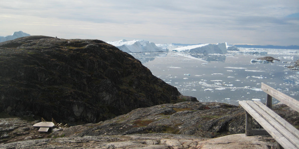
In the afternoon, Peter went on a helicopter ride above the Ilulissat Ice Fjord while I chose to hike the area. I disembarked at Ilulissat and traveled via a local bus to the Semermuit Ice Fjord. A hike along the edge of the fjord provided stupendous views of a massive number of icebergs that have calved from Sermeq Kujalleq.
Helicopter ride over the Ilulissat Ice Fjord
Le Boreal from the air
Here are some of the dramatic photos from our afternoon explorations. As we headed back to our ship, the ice was starting to drift into the bay. Even though it was only the third week in August, the "tourist" season north of the Arctic Circle was coming to an end. Unlike common cruise ships, the well-equipped Le Boreal felt at home with its advanced ice navigation and maneuvering technology.
1 / 6
At the beginning of the hike to the ridge overlooking part of Disko Bay
2 / 6
Hikers sitting on bench at the top of the ridge (the view is continually changing)
3 / 6
I arrived at the same bench on the ridge
4 / 6
On my way down
5 / 6
Ilulissat harbor with heavy ice moving in
6 / 6
It is not easy getting back to the Le Boreal through the shifting ice
The following day our ship navigated through Eternity Fjord — surrounded by some of the highest mountains in West Greenland rising vertically to over a mile above sea level. It was the best weather yet with a bright blue sky as we used the Zodiacs to explore the shore's sandy beaches.
Panoramic view approaching Eternity Fjord on our way south
1 / 5
Dramatic glacier cliff at Eternity Fjord
2 / 5
Peter saying goodbye at Eternity Fjord with the map of Greenland proudly displayed on his chest
3 / 5
My last photo of the Le Boreal from a Zodiac
4 / 5
Inside the bridge (close to our cabin) with our famous Captain Patrick Marchesseau in the center
5 / 5
Our group of eight University of Michigan Alumni at Eternity Fjord
Our expedition ended at Kangerlussuaq where we disembarked before flying back to Reykjavik. This small town in western Greenland is at the eastern end of a deep fjord and is surrounded by breathtaking landscapes and wildlife. Kangerlussuaq was used as an American Airforce base during the Cold War. Today it serves as Greenland's transportation hub. The beautiful sunset shown below was from our last evening.

 In August 2013, we embarked upon a trip to Greenland. With its ice cap and glaciers melting at a rapid rate, Greenland is often at the center of the climate change conversation. It is far off the beaten path — so vast and remote — that even today exploring Greenland seems reminiscent of the spirit of exploration of centuries gone by. Our small ship expedition took us deeper into the fjords of this pristine Arctic wilderness — where large vessels simply cannot go.